© Montafon Tourismus, Schruns

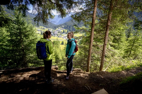
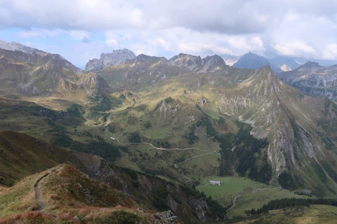
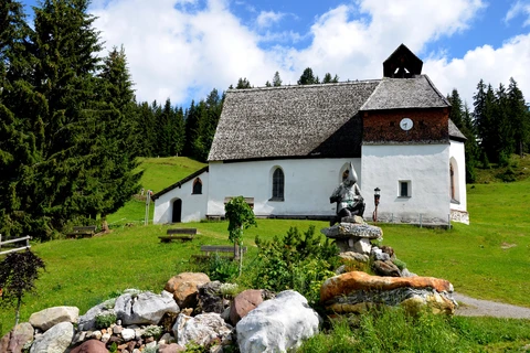
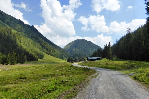
Mountain and hiking tours in the Montafon, Vorarlberg

Find your favourite tour on 1,161 km of marked hiking trails

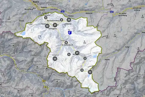
With a comprehensive hiking network in the Rätikon, the Silvretta and in Verwall, the Montafon was made for hikers and mountain climbers. You will find the loveliest hiking tours, high-altitude trails, chalet hikes and mountain experiences in the southernmost valley in Vorarlberg with the interactive map.

Our recommendations

Fritzensee in Bartholomäberg | © Montafon Tourismus GmbH Schruns, Daniel Zangerl

Via the historic mine and Fritzensee to Rellseck

medium-difficulty hike | 7.2 km | 2.35 hrs | ↗ 467 vm |
↘ 467 vm
Weg entlang des Silvrettasees | © Montafon Tourismus GmbH Schruns, Roland Fritsch

Silvretta-Bielerhöhe - lake loop path

medium-difficulty hike | 6.4 km | 2.45 hrs | ↗ 215 vm |
↘ 215 vm

Silbertal legend trail

medium-difficulty hike | 14.9 km | 4.39 hrs | ↗ 318 vm |
↘ 881 vm
Langsee im hinteren Silbertal | © Patrick Säly

Montafon Verwall loop

difficult hike | 36.5 km | 13.35 hrs | ↗ 1,533 vm |
↘ 1,434 vm

From Kristberg to Silbertal via the Gretschersee and Lower Gaflunaalpe

medium-difficulty hike | 22.1 km | 7.27 hrs | ↗ 877 vm |
↘ 1,441 vm
© Montafon Tourismus GmbH, Schruns

Schruns culture trail

easy hike | 3.1 km | 0.59 hrs | ↗ 87 vm | ↘ 87 vm
© Montaofn Tourismus GmbH

Bergknappenweg Kristberg - Schruns

medium-difficulty hike | 12.2 km | 3.48 hrs | ↗ 169 vm |
↘ 922 vm

Montafon Rätikon loop

difficult hike | 44.6 km | 18.45 hrs | ↗ 2,287 vm |
↘ 3,185 vm
© Montafon Tourismus GmbH Schruns, Stefan Kothner

Alpe Nova hike via the Gantakopf panorama trail (1,958 m)

medium-difficulty hike | 9.2 km | 3.20 hrs | ↗ 491 vm |
↘ 492 vm
Landschaft Rellseck | © Montafon Tourismus GmbH

Via Rellseck to the Itonskopf (2,089 m)

difficult hike | 15.4 km | 6.10 hrs | ↗ 1,077 vm |
↘ 1,075 vm
Tübinger Hütte | © Montafon Tourismus GmbH, Andreas Haller

Montafon Silvretta loop

difficult hike | 48.7 km | 21.55 hrs | ↗ 2,566 vm |
↘ 3,612 vm
Wiegensee | © Montafon Tourismus GmbH, Stefan Kothner

The landscape trail - from Wiegensee lake to the Verbellaalpe and through the Ganifertal valley to Partenen

medium-difficulty hike | 12.8 km | 4.45 hrs | ↗ 484 vm |
↘ 988 vm
© Montafon Tourismus GmbH Schruns, Daniel Zangerl

Smugglers’ Path - Crossing borders

medium-difficulty hike | 8.5 km | 5.00 hrs | ↗ 601 vm |
↘ 601 vm
© Montafon Tourismus GmbH Schruns, Andreas Haller

Gauertaler AlpkulTour (Alpine tour)

medium-difficulty hike | 11.2 km | 4.00 hrs | ↗ 110 vm |
↘ 1,009 vm

Gargellen Window loop hiking trail

medium-difficulty hike | 6.7 km | 2.37 hrs | ↗ 370 vm |
↘ 371 vm
Haven’t found the right one yet? You can find more right here!
All hiking trails in the Montafon


Mountain and hiking tours overview


Montafon Weather

Bartholomäberg
11°C
Gargellen
8°C
Gaschurn-Partenen
12°C
St. Anton im Montafon
16°C
St. Gallenkirch-Gortipohl
14°C
Schruns-Tschagguns
15°C
Silbertal
14°C
Vandans
16°C

Webcams

Your window on us in the Montafon

Kristallbahn Gargellen

2.277 m, Gargellen

Find a host

We are happy to help you find the right accommodation.

Room / Apartment 1
Age of children

Your direct booking advantages

  • We know our hosts personally
  • Best price and largest selection
  • Free and secure booking
  • Maximum protection: Booking on the official website montafon.at
Book your personal holiday now!

MontaPhone

We are here to help you.

You can reach the Montafon tourism office service centre by telephone and email:

Monday to Friday from 8 am to 12 pm and from 2 pm to 5 pm
Saturday, Sunday and bank holidays from 9 am to 3 pm

T. +43 50 6686
E-Mail info@montafon.at
Service centre Montafon | © Montafon Tourismus GmbH Schruns, Nona Büchele